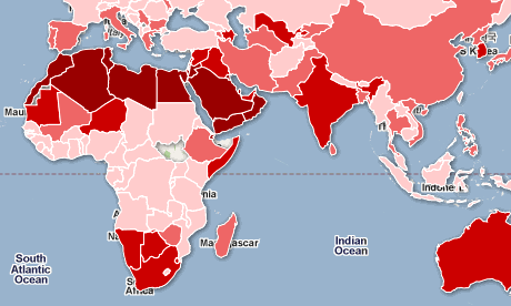
Unclassed chloropleth maps do not classify in intervals as classed chloropleths do but instead assign shades or colors to indicate higher or lower levels. This map of level of water scarcity in the Middle East and African uses red shades to represent scarcity, darker red showing more scarcity. This map was made with data compiled from the United Nations Food and Agriculture Organizations Aquastat tool and a summary of a 2011 commercial dataset.
No comments:
Post a Comment